


The Township of Greater Madawaska provides a variety of different experiences that range from walking to boating and snowmobiling and ATV trails.
ATV |
||||||
|
Noted for the unsurpassed natural beauty of its extensive trails network, Calabogie and the Township of Greater Madawaska is one of Ontario's premiere ATV destinations. Using a combination of abandoned rail lines and forest access roads, here you will find some of the most scenic trails in the province as you pass through muddy wetlands, beautiful forests, alongside pristine lakes and rivers and over rolling hill and mountains. Stunning panoramic views abound. Literally hundreds of kilometers of trails are her or you to explore. Trail information: Tom Irwin Adventure Tours Ltd offers ATV and side-by-side rentals including full guided tours of the township. The business is located at 636 Mill Street in Calabogie. Their fleet is professionally inspected and maintained to ensure the safety of the guests. They supply helmets and gloves with ATV rentals. |
||||||
Biking, Cycling and Mountain Biking |
||||||
|
The Township offers good roads, light traffic, variety and challenging mountain terrain and scenic beauty are all reasons why Greater Madawaska has become a popular cycling and mountain biking destination. Parking can be found in Calabogie at Barnet Park (5179 Calabogie Rd) and Heritage Point (12517 Lanark Rd). Calabogie Peaks Resort offers a variety of cycling and mountain terrain riding. The Eagle's Nest trail system is far more picturesque and challenging then the Peaks Village trails and known for its scenic vistas from the Eagle's Nest Escarpment. The technical ability to tackle the Eagle's Nest Loop is intermediate to advanced. The Peaks Village trail system is made up of single & double track trails. The single-track trails loop off the existing Nordic ski trail system. The technical ability required ranges from intermediate to advanced. Double tracks are fairly flat with a few gradual climbs, the technical difficulty ranges from beginner to intermediate. |
||||||
Canoe and Kayaking – Flatwater |
||||||
|
The Madawaska River Paddle Trail – one of Ontario's great rivers, the Madawaska River, flows 230 kilometers eastward from its origins in Algonquin Park before merging with the Ottawa River at Arnprior. Along the way it passes through some of the most rugged and most beautiful countryside in the province. Its history is rich and varied. In the 1800's it was used by the lumber industry to float logs to the mills downstream. In the 1960's, with the building of five generating stations along its route, it became a major source of hydroelectric power. Today it attracts paddlers, both whitewater and flatwater, from around the world and is rapidly becoming one of the Ontario's primary paddling destinations. Undoubtedly one of the most beautiful and easily accessible sections of the Madawaska River is the 60 kilometer stretch of river from Griffith to Burnstown. Here paddlers can find an outstanding paddling experience to match their interests and skills. Whether you are looking for an outing lasting several hours or several days; for whitewater or flatwater paddling; you will find it here in Greater Madawaska. Maps: The Township offers a variety of lake systems for canoeing and kayaking such as
|
||||||
Canoe and Kayak – Whitewater |
||||||
|
Whitewater paddling in Griffith- The Ottawa Valley is Canada's whitewater capital, and you will find some of the best whitewater paddling in Ontario on the Madawaska River upriver from Griffith. A highly recommended day trip starts at Aumond Bay with a 20-kilometer paddle downstream to Griffith. On route you will experience 10 sets of rapids. Early in the season these rapids are classified as Class 11-111 diminishing to Class 1-11 as the season progresses. Portages around all the rapids are well marked if you should decide that any of the rapids are a bit to challenging. This stretch of the Madawaska River also flows through Lower Madawaska Provincial Park where there are 36 well maintained campsites for those wishing to extend their whitewater adventure. You do not even need your own canoe or kayak. Don Adams at Greater Madawaska Canoe Rentals in Griffith offers rentals and shuttle services. Map: |
||||||
Fishing |
||||||
|
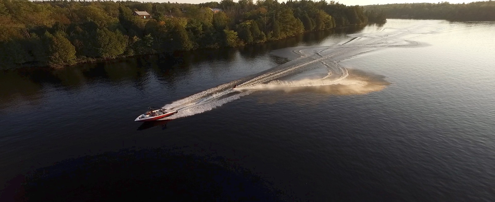
You will find excellent fishing in Greater Madawaska. The fish are plentiful, the fish species diverse. Game fish species include walleye (pickerel, doré), northern pike, small and large mouth bass, yellow perch, brown bullhead, channel catfish, rock bass and various species of trout. Here in Greater Madawaska the 65-kilometer Madawaska River system with its associated lakes – Black Donald, Centennial, Norcan and Calabogie, is the most popular and most easily accessible area for fishing. In addition, the Township has literally hundreds of smaller, more remote lakes for those fishermen wanting something a little different. Fishing maps of the area lakes are highly recommended: Fishing regulations: |
||||||
Geocache |
||||||
|
Geocaching is a real-world outdoor treasure hunting game. Players try to locate hidden containers, called geocaches, using GPS-enabled devices and then share their experiences online. In the Township of Greater Madawaska, you will find more than 70 geocache sites. To get them you can walk, hike, ride, or paddle; they range from easy to difficult. There's geocaching for you. To find geocache(s):
Calabogie - K0J 1H0 Griffith/Matawatchan - K0J 2R0 Dacre/Mount St. Patrick - K0J 1N0 |
||||||
Golf |
||||||
|
Two scenic and challenging golf courses can be found in Greater Madawaska both are in Calabogie: |
||||||
Hike - Eagles Nest/Manitou / Griffith Uplands /Nordic Trail |
||||||
|
Greater Madawaska has emerged as one of the Ontario's premiere hiking destinations. Choose from several unique hiking trails…. there is one or more ideally suited to your interests and abilities.
|
||||||
Motorsports |
||||||
|
Since the fall of 2006, Calabogie MotorSports Park has become the preferred destination for North American motorsports enthusiasts. This world-class facility is home to Canada's longest track, consisting of 20 turns, measuring 40 feet wide and features a 2,000 ft straightaway. Whether a driver, rider or enthusiast, the road course at Calabogie MotorSports Park is host to a large number of club events for both cars and motorcycles. Track days, corporate events, race team testing, driver education, major manufacturer product launches and races are examples of the many activities that take place at this facility. |
||||||
Scenic Drives |
||||||
|
The Ottawa Valley is noted for its scenic drives and one of the most scenic, most interesting drives is located here in Greater Madawaska. Calabogie Road: Calabogie-Griffith-Dacre-Mount St. Patrick This 140 km scenic drive is a lovely drive at any time of year, but it is particularly beautiful in the Fall when the autumn colours are at their peak. The drive being on Highway 17, mid-way between Arnprior and Renfrew, and follows Calabogie Road to Burnstown, Calabogie and on to Griffith, Dacre and Mount St. Patrick before returning to Calabogie and then back to Highway 17. In addition to the natural beauty of the area, along the way you will find several points of interest worth a stop. Beginning at Highway 17, Calabogie Road winds its way alongside the beautiful Madawaska River to Burnstown, a charming and picturesque hamlet dating back to the 1800's well known for its art and artisans. Don't' miss the views from the Burnstown bridge high above the Madawaska River. The drive from Burnstown to Calabogie is very as it winds its way along the Madawaska River. Consider stopping at the Cherry Point picnic area 3 km north of Calabogie for outstanding views of the river. A.Y. Jackson, one of Canada's famous Group of Seven, was known to have painted here. As you pass through Calabogie and alongside Calabogie Lake a stop at Barnet Park to enjoy the panoramic lake views is worthwhile. Your drive then takes you past Calabogie Peaks Resort and into the rugged mountains and forest of the Calabogie wilderness. 9km's later Calabogie road ends and becomes Centennial Lake Road. Just before that look for Hydro Dam Road. An interesting side trip is the 6 km drive to the bridge over the Madawaska River at the base of the Mountain Chute Hydro Dam. Here you will find a lovely view of the Madawaska River with the 180 ft. high, 1300 ft. wide hydro dam as a backdrop. It is a sobering thought knowing the Mountain Chute Dam standing high above you is holding back the 200 ft deep Black Donald Lake. Returning to the main highway and continuing Centennial Lake Road you pass Black Donald Lake and Centennial Lake before once again coming alongside the Madawaska River. The highway winds through old forest and past rock cuts along the way. Centennial Lake Road ends at Matawatchan Rd. Turn right and follow the river road 10 km to Griffith. At Griffith turn right on Highway 41 and drive 22 km north then stay right onto highway 132 to Dacre. At Dacre, turn right on flat Road following it 8 km to its end at Kennelly Mountain Rd. At this intersection you should consider a short trip to the Holy Well. Turn left and take Mount St. Patrick Road 2 km into Mount St. Patrick. Just beyond the church, on your left, take Holy Well Road. The religious history of the Holy well and its importance to the local area is documented in the small building surrounding the well and makes for a very interesting read, Retracing your steps back to the Flat Road intersection, continue 1 km on Kennelly Mountain Road to Ferguson Lake Road. Follow Ferguson Lake Road 9 km ending at Calabogie Road. Turn left and follow Calabogie Road back into Calabogie and on to Burnstown and your starting point at Highway 17. Calabogie & Area Map is a great resource to help you get around. |
||||||
Skate |
||||||
|
During the winter months, Greater Madawaska maintains 2 public outdoor skating rinks: Check the Facilities Page for more information about the Rinks. |
||||||
Ski/Snowboard |
||||||
|
Without a doubt, the finest skiing and snowboarding in Eastern Ontario/Western Quebec can be found here in Greater Madawaska at Calabogie Peaks Resort. |
||||||
Snowshoe/Cross Country Ski |
||||||
|
The Madawaska Nordic Trails are great for cross-country skiing and snowshoeing. Visit their Facebook page for updates about the Trails. |
||||||
Snowmobile |
||||||
|
Noted for the natural beauty of its extensive trail network and the quality of its trail maintenance and grooming, the Township of Greater Madawaska have long been one of Ontario's premier snowmobile destinations. Here you will find some of the most scenic trails in the province as you pass though beautiful forest landscapes, alongside pristine lakes and rivers and over rolling hills and mountains. Stunning panoramic views abound. It is all right here. The Ontario Federation of Snowmobile Clubs provides information regarding local clubs and trail systems. |
||||||
Swim |
||||||
|
Barnet Park located at 5179 Calabogie Road, is open to the public and boasts approximately seven acres including a public boat launch, two beaches, two gazebos, a picnic shelter, picnic tables, and lots of grassy areas for the public's enjoyment. Almost all our resorts, motels, B&B's, rental accommodations, and campgrounds are located on the water and have swimming available for their guests. With some 60% of Greater Madawaska being Crown land and with the Madawaska River and the many lakes within the township, one can find an almost endless number of locations for swimming in our beautiful natural environment. Access to most of these locations is generally not available by road and requires water access. |
Contact Us
 Subscribe to this page